![GOSAT PROJECT [ THE GREENHOUSE GASES OBSERVING SATELLITE: GOSAT 'IBUKI' ]](../../img/img_top.jpg)
2011
June, 2011
June 17, 2011
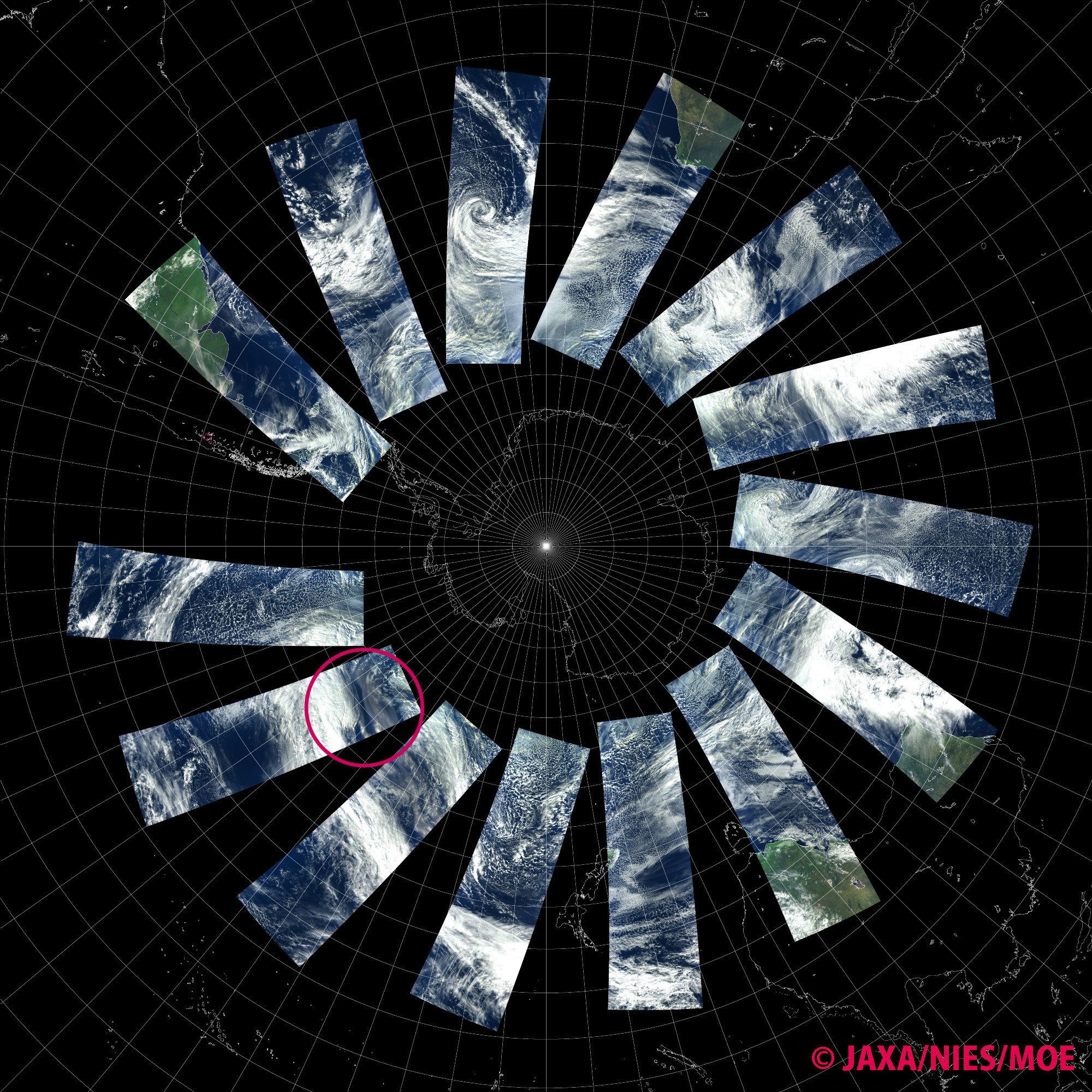
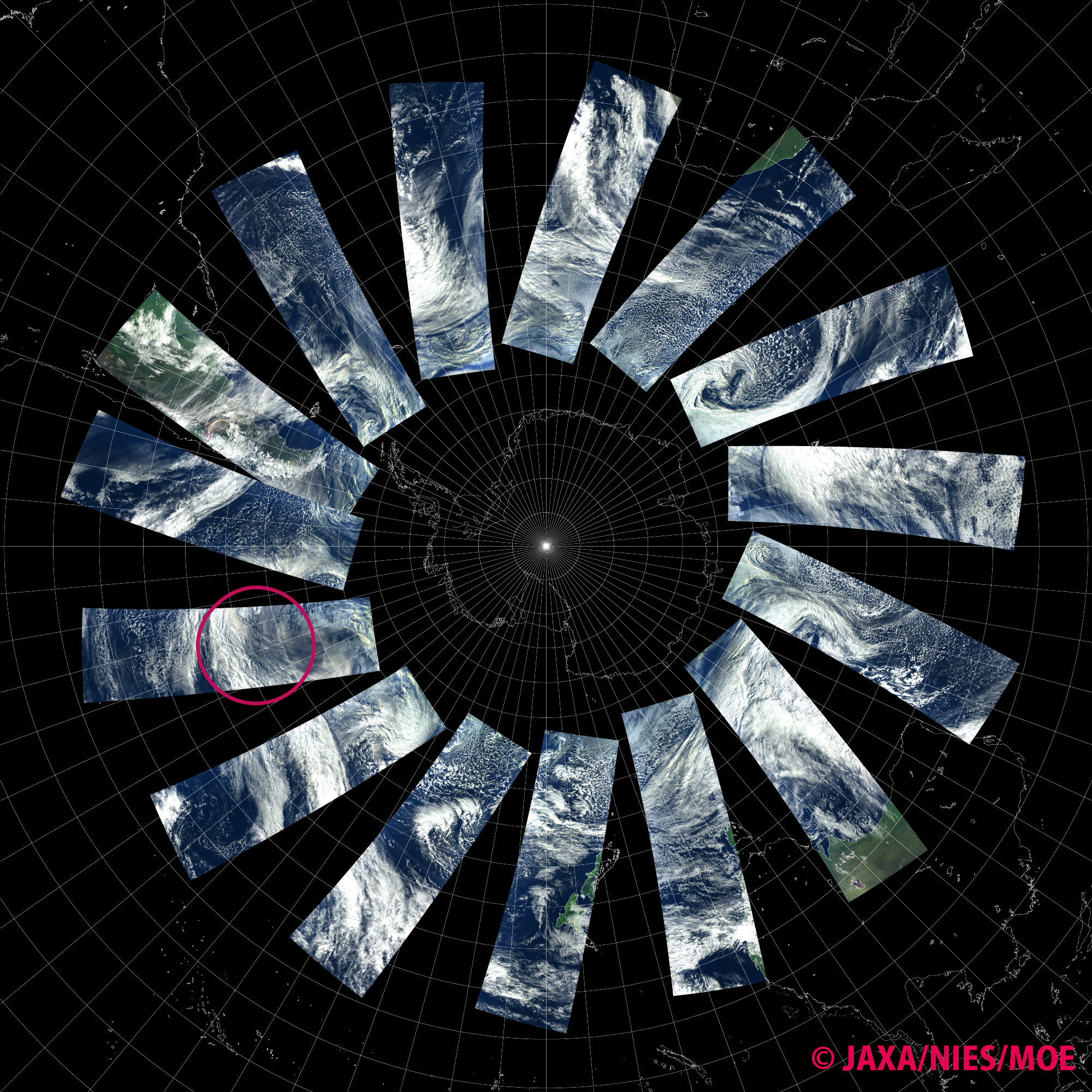
"IBUKI" captured the plume of Puyehue volcano as it moves around the world and comes back to South America. In the image acquired on June 14, 2011, Puyehue volcano is still in eruption and the spewed plume is drifting southeastward. Over the Pacific Ocean west of the volcano, there is an area where clouds are blurry light brown because of the plume that made its way around the world. A part of the cloud is reaching the southern tip of South America. In the image acquired on June 15, the plume is spewed southeastward from the volcano, but there is also some plume coming from the north west towards the volcano. The red circle indicates the location of Puyehue volcano.
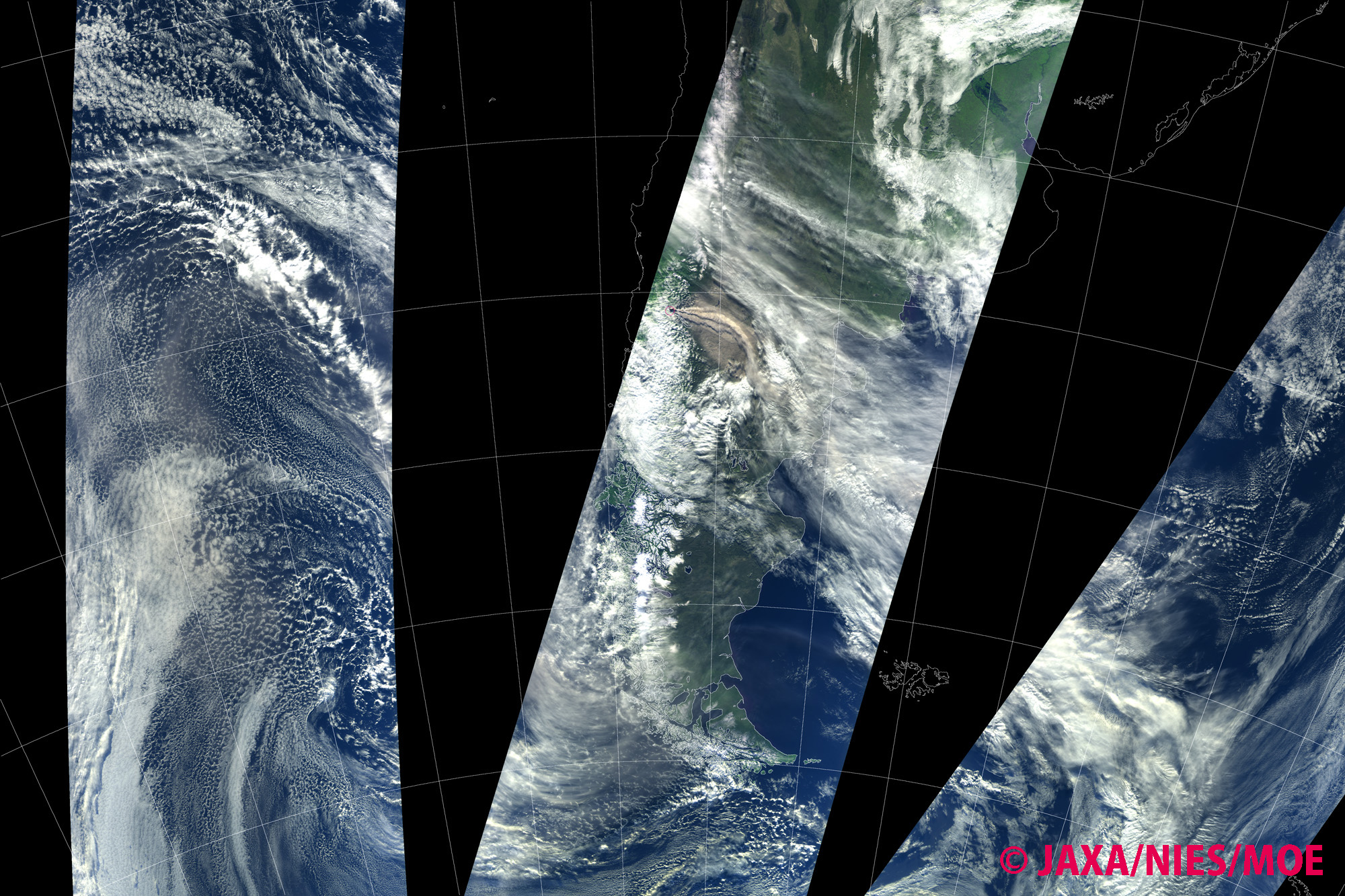
Image 1. The Puyehue volcano on June 14. There is a plume that has made its way around the world drifting over the Pacific Ocean west of the volcano. "IBUKI" passed over the area at 15:09, 16:47, 18:25 (UTC).
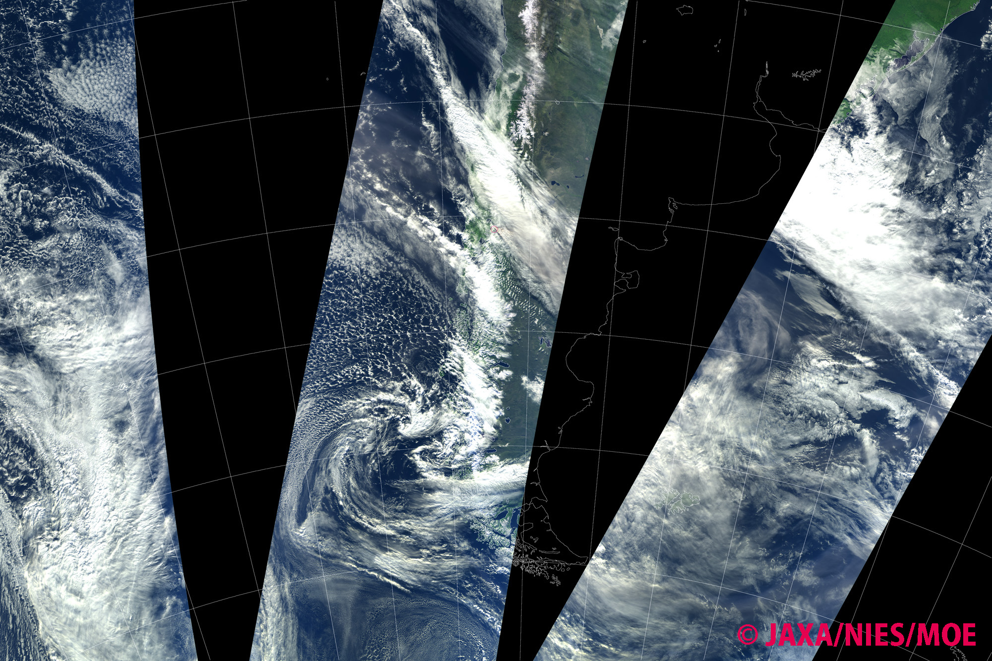
Image 2. Puyehue volcano on June 15. There is a plume approaching the volcano from the north west. "IBUKI" passed over the area at 15:41, 17:20, 18:58 (UTC).
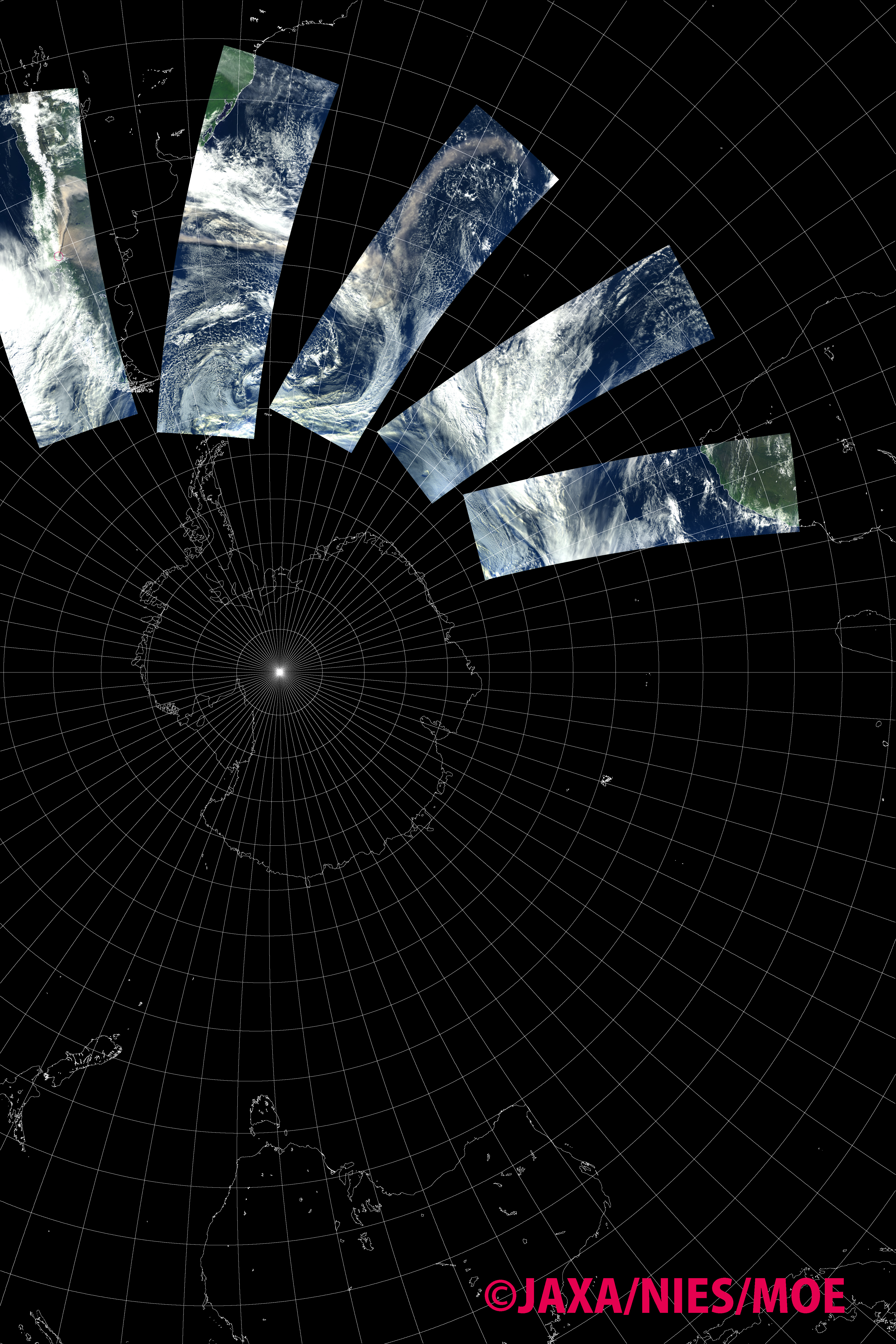
The images are composites of images acquired by "IBUKI" over the area in different orbit paths. The red circle indicates the are where the front of drifting plume can be.
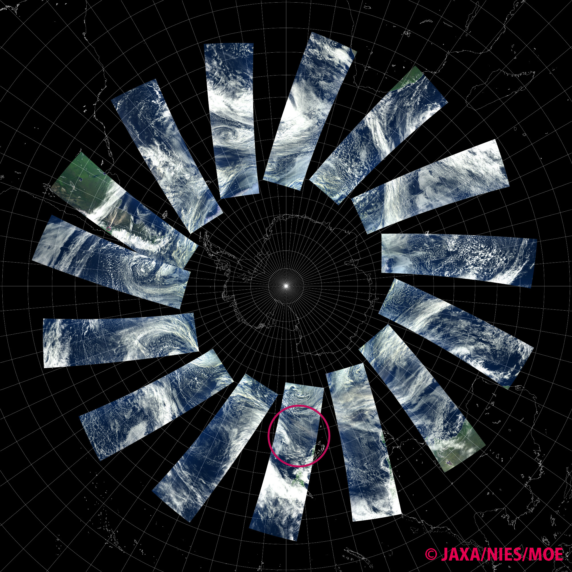
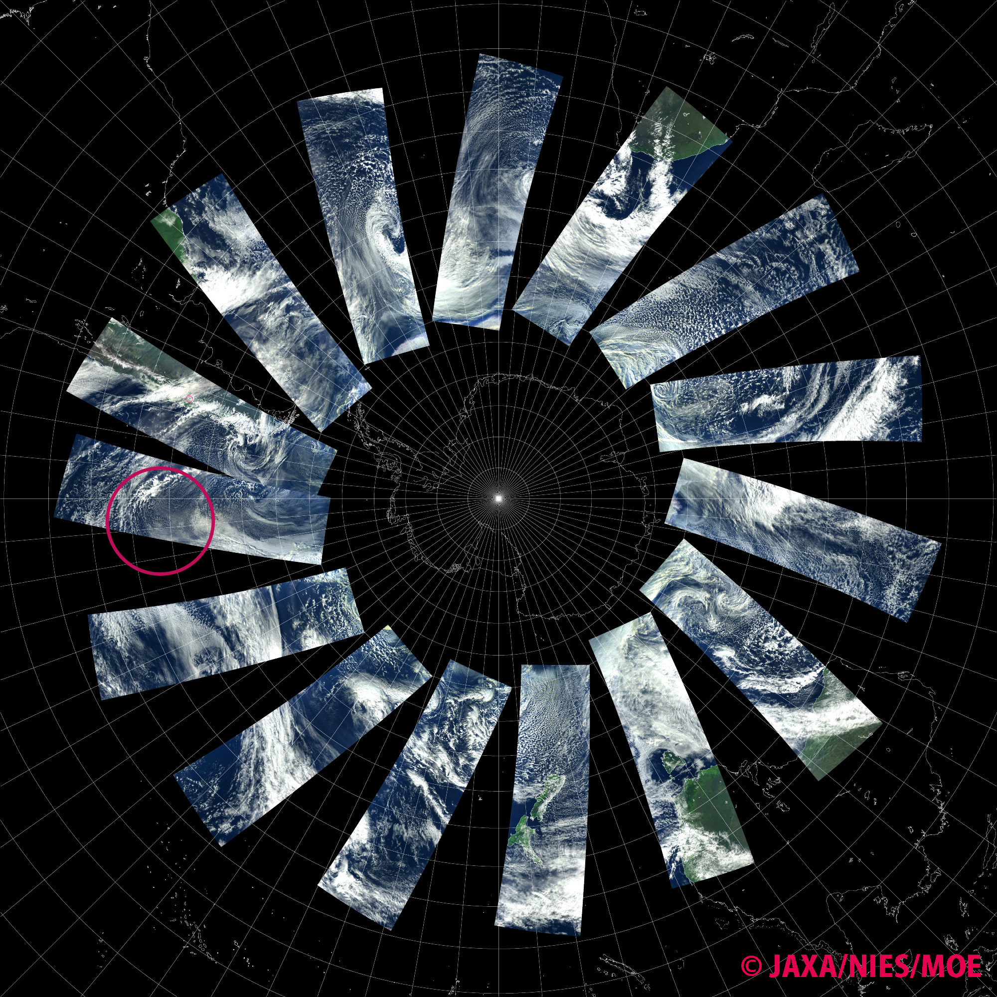
(From top)
June 10 - 11, 2011,
June 11 - 12,
June 12 - 13,
June 13 - 14,
June 14 - 15.
June 14, 2011
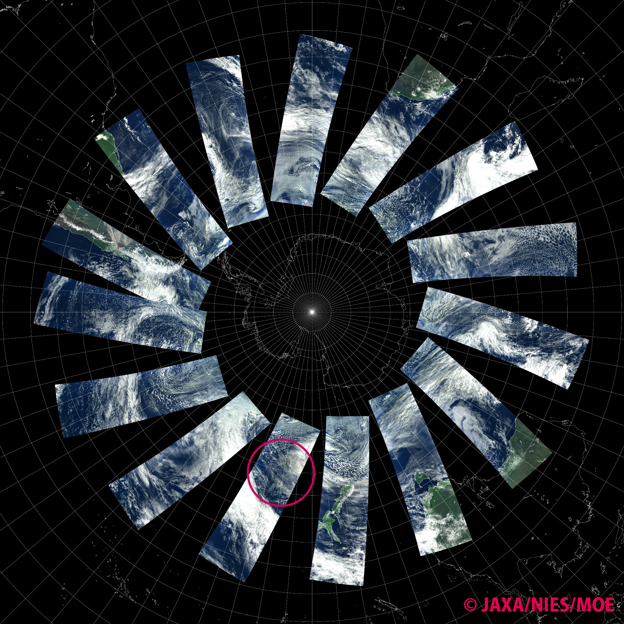
The Puyehue volcano erupted in Chile on June 4, 2011. In the image taken by "IBUKI" on June 5, 2011, the plume drifts over southern Argentina and is reaching the Atlantic Ocean. On June 8, 2011, the plume spreads over the ocean south of Africa and is reaching Indian Ocean. By June 11, 2011, the volcanic plume reaches New Zealand drifting over the ocean south of Australia.
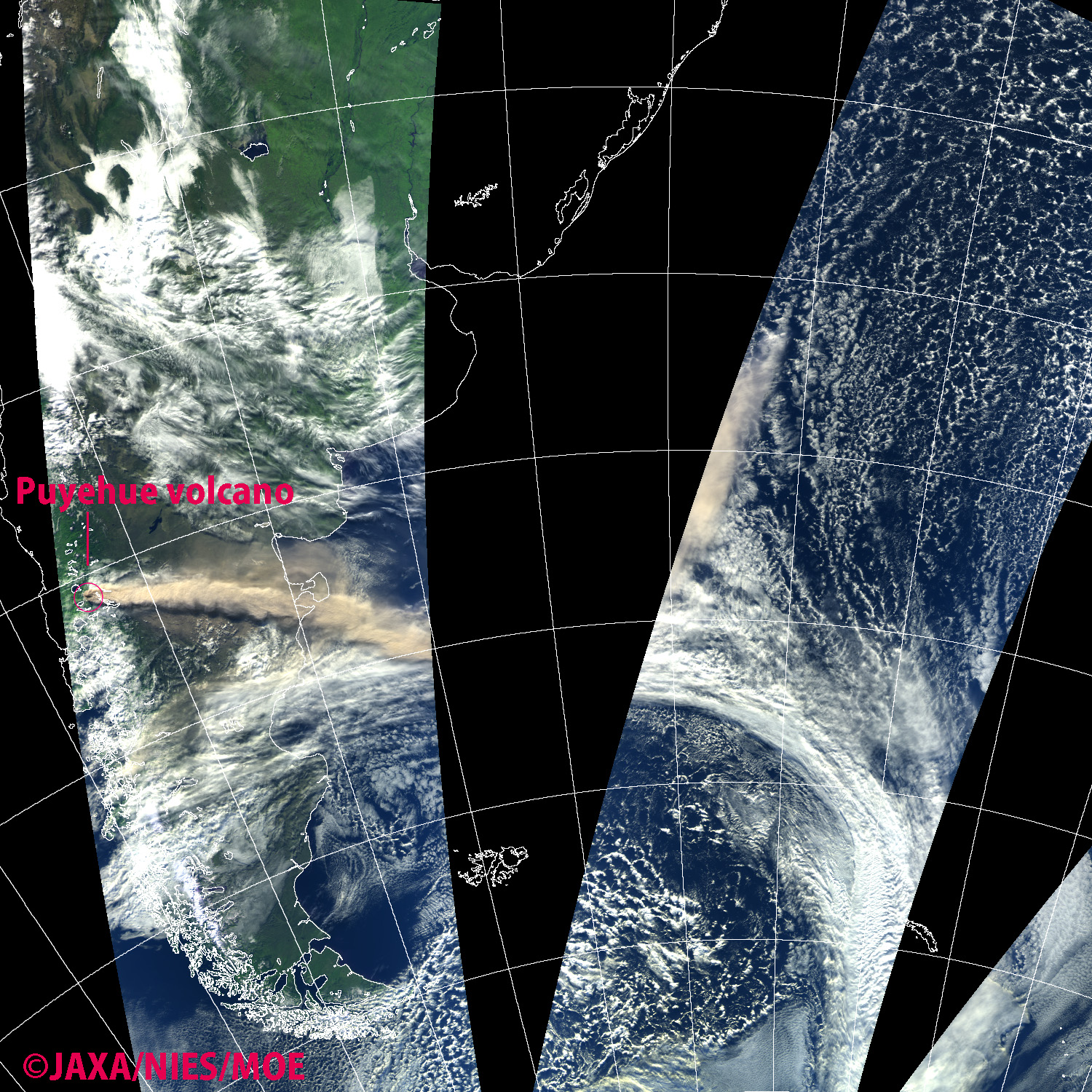
Image 1. An image from "IBUKI" when the satellite passed over South America on June 5, 2011 at (from right) 13:30, 15:09, and 16:47 (UTC). The red circle indicates the location of the Puyehue volcano. The volcanic plume (light brown) is pushed by westerly winds and drifting to the Atlantic Ocean.
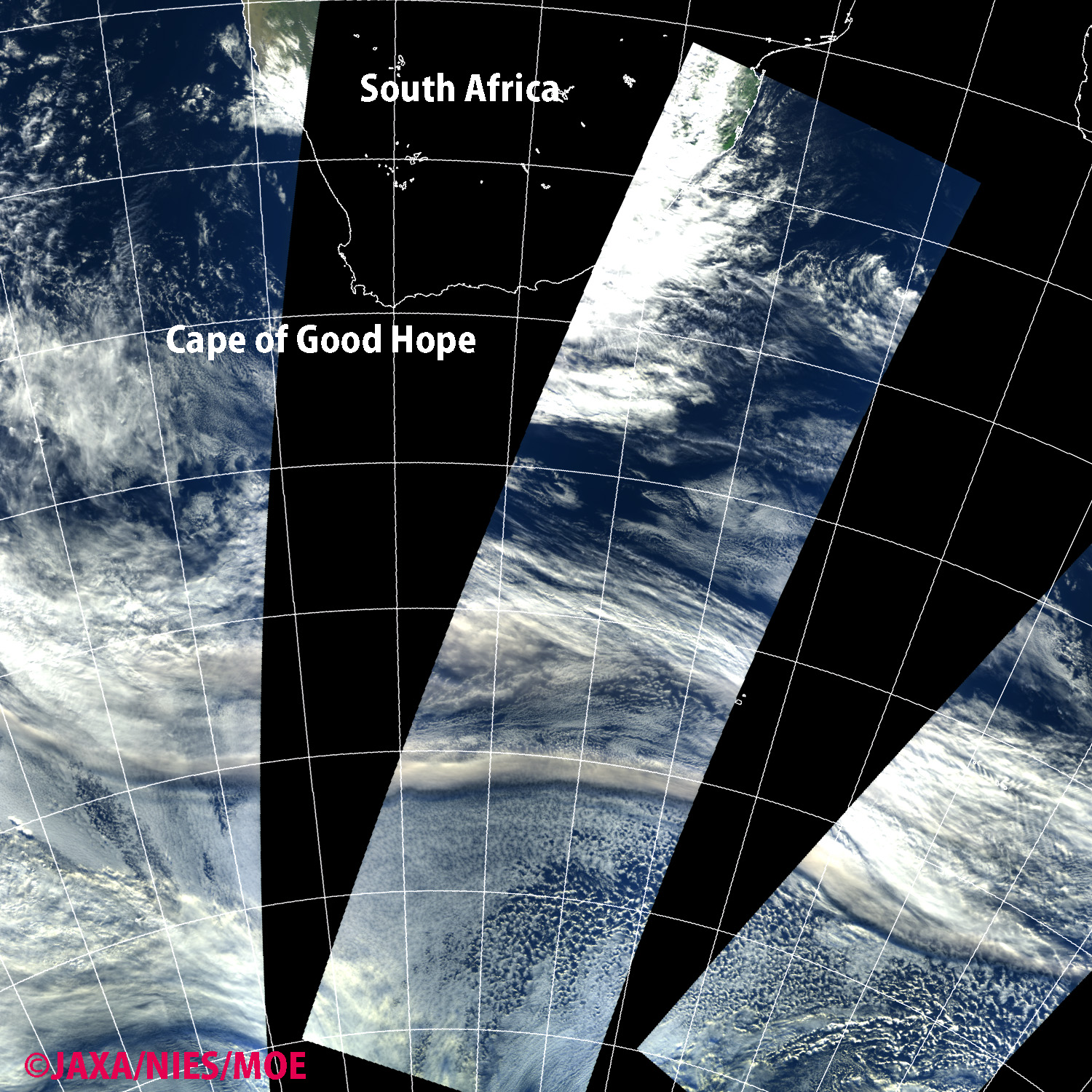
Image 2. An image from "IBUKI" when the satellite passed over Africa on June 8, 2011 at (from right) 08:36, 10:14, and 11:52 (UTC). The volcanic plume passes over the ocean south of Africa and is reaching Indian Ocean.
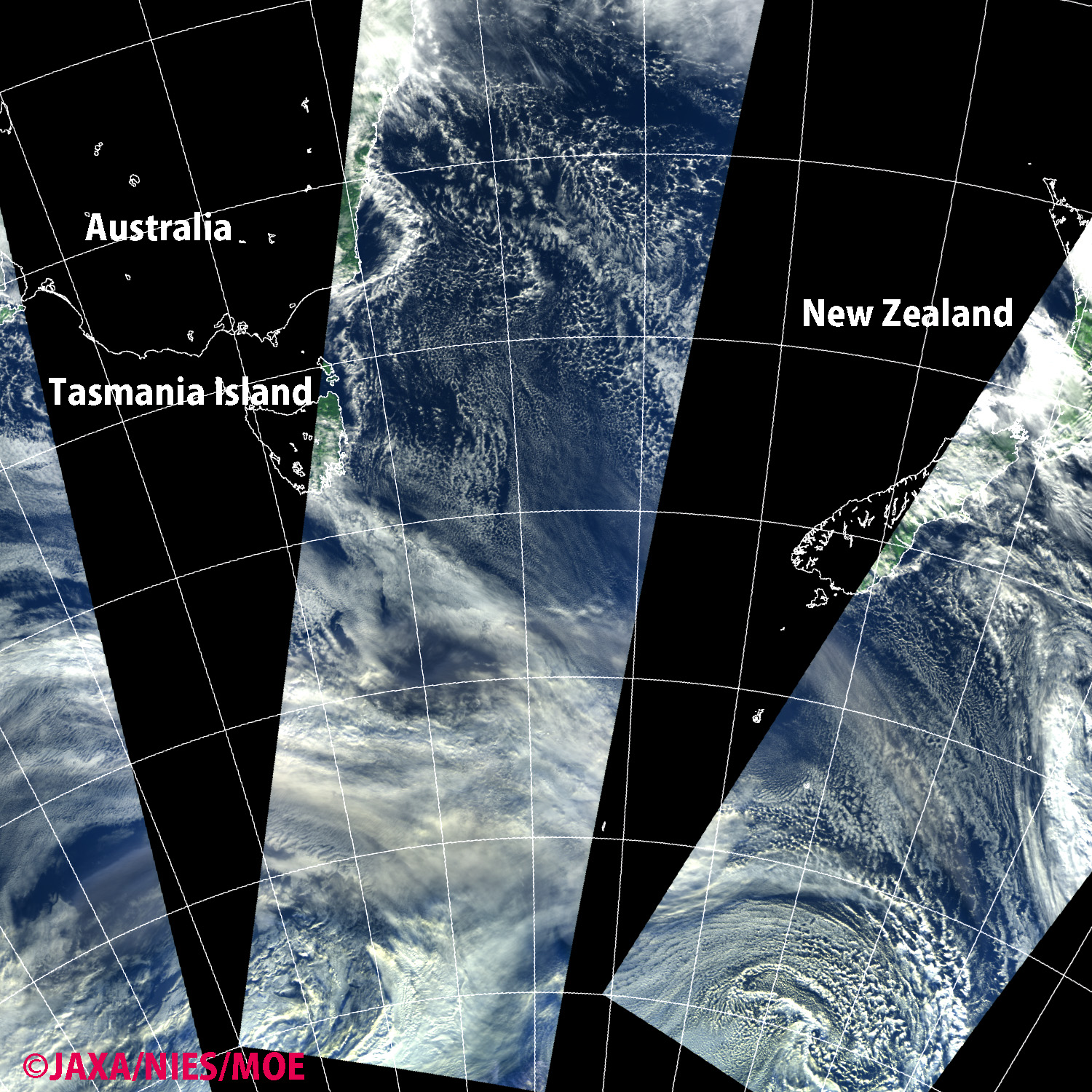
Image 3. An image from "IBUKI" when the satellite passed near Australia on June 11, 2011 at (from right) 00:25, 02:03, and 03:41 (UTC). The volcanic plume reaches New Zealand after drifting over the ocean south of Australia.


The images are composites of images acquired by "IBUKI" over the area in different orbit paths. (Top from left) June 5, 2011, June 6, June 7, June 8. (bottom from left) June 9, 2011, June 10, June 11, June 12,
June 10, 2011
"IBUKI"'s data will be exhibited at the National Museum of Emerging Science and Innovation (Miraikan) in Odaiba, Tokyo as a part of its "TSUNAGARI" Project.
"TSUNAGARI" ("link", "connection" etc. in Japanese) Project is Miraikan's new project dedicated to understanding the Earth by using 3 tools, "Geo-Cosmos," "Geo-Scope," and "Geo-Palette." Geo-Cosmos, a 6-meter globe-like organic LED display, will exhibit the seasonal variation of carbon dioxide concentration on the entire globe observed by "IBUKI." "IBUKI"'s data can also be found on Geo-Scope, interactive touch-panel boards for viewing the earth observation data collected from all around the world. "TSUNAGARI" Project will start as Miraikan reopens on June 11, 2011, after being closed due to the earthquake on March 11, 2011.
The National Museum of Emerging Science and Innovation (Miraikan) URL:
http://www.miraikan.jst.go.jp/en/
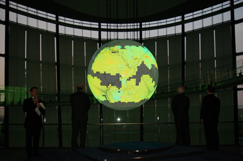
Photo 1. " CO2 Map by 'IBUKI' "displayed on Miraikan's symbol exhibition, an globe-like organic LED display, Geo-Cosmos.
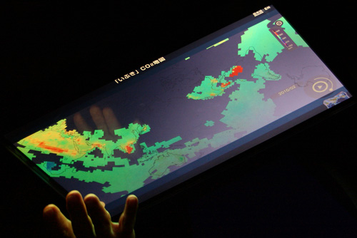
Photo 2. "CO2 Map by 'IBUKI'" displayed on one of Miraikan's interactive boards, Geo-Scope.

Photo 3. On June 3 at Miraikan. GOSAT Project members are greeted by Chief Executive Director Mamoru Mouri of Miraikan.

Photo 4. Chief Executive Director Mouri Mamoru of Miraikan on June 3 at the private viewing. The content displayed on Geo-Cosmos is "The Earth" (Data provided by : University of Wisconsin SSEC).