![GOSAT PROJECT [ THE GREENHOUSE GASES OBSERVING SATELLITE: GOSAT 'IBUKI' ]](../../img/img_top.jpg)
2010
April, 2010
April 20, 21, 22, 23 2010
Greenhouse Gases Observing Satellite (GOSAT or "IBUKI", launched on Jan. 23, 2009) project is a joint effort among Ministry of the Environment, National Institute for Environmental Studies, and Japan Aerospace Exploration Agency. Here we report IBUKI's observation of volcanic eruptions in Iceland and their spreading ash plume.
Since March 2010, intermittent volcanic activities were observed in a glacier region about 100 km southeast of Reykjavik, the Capital city of Iceland, and on April 14 and 17, large scale eruptions occurred. As the ash plume of these eruptions reached the large areas in Europe, many European countries took emergency measures such as cancellation of commercial passenger flights and shutdown of airports.
"IBUKI" observes the whole globe every three days using one of its instruments, Cloud and Aerosol Imager (TANSO-CAI). It is confirmed that the spread of volcanic plume over Europe was captured by CAI after April 15. On April 17, another large scale eruption occurred in Iceland was also captured.
Update (April 20, 2010) : Figure 8 and Figure 9 (A latest image taken on April 19, 2010) were added.
Update (April 21, 2010) : Figure 10 (A latest image taken on April 20, 2010) was added.
Update (April 22, 2010) : Figure 11 (A latest image taken on April 21, 2010) was added.
Update (April 23, 2010) : Figure 11 and Figure 9 (A latest image taken on April 22, 2010) were added.
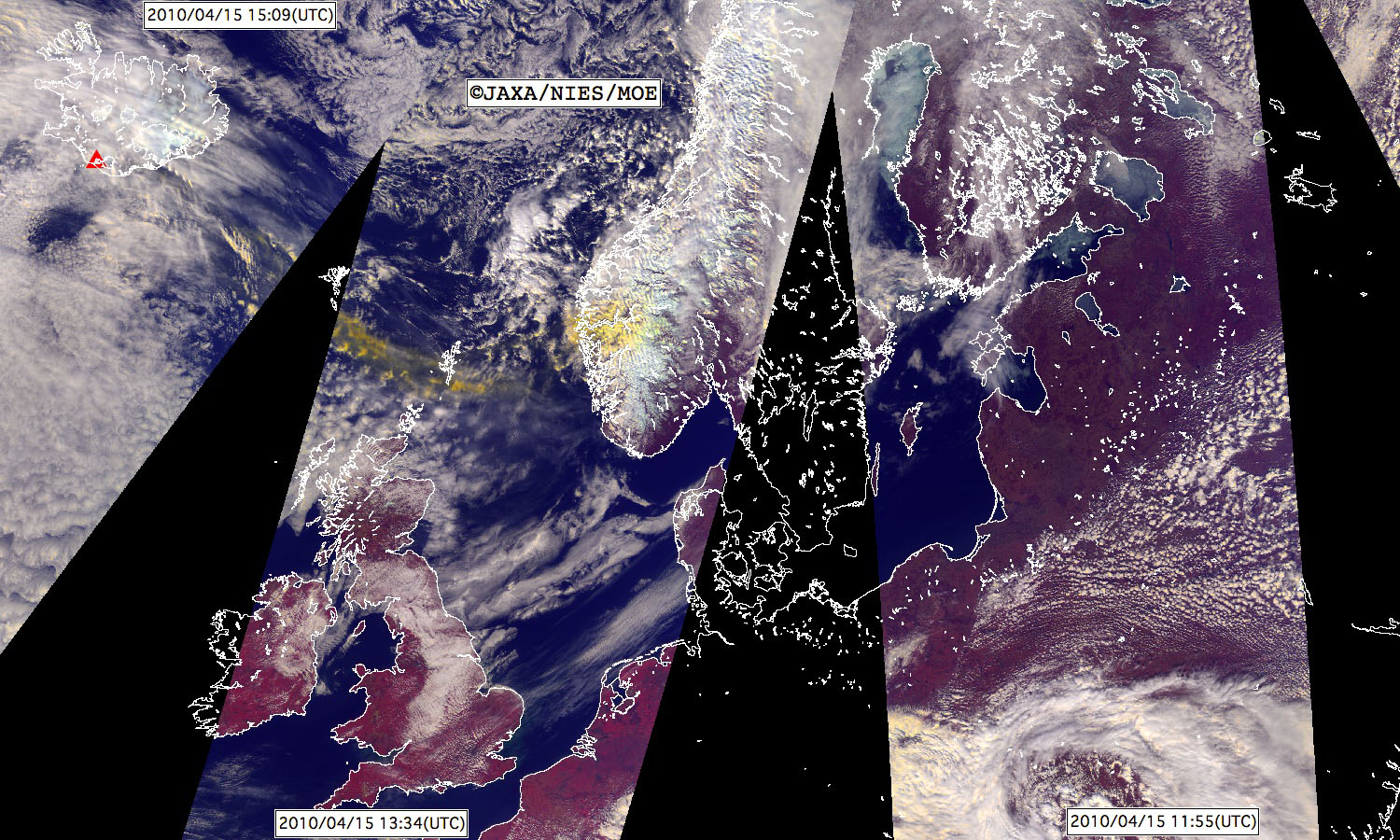
Figure 1. The spread of volcanic plume from Iceland observed by "IBUKI" on April 15, 2010 (JST:Japanese Standard Time). This is a color composite image in which red, green, and blue are assigned to 870 nm, 678 nm, and 380 nm spectral channels* of TANSO-CAI onboard GOSAT. Clouds, snow, and sea ices are shown in white, terrestrial vegetation in red, and volcanic plume in yellow. This image was made from images acquired by "IBUKI" when it flew over Europe four times on April 15**. Black regions are the areas where "IBUKI" could not observe. A red triangle indicates the location of the erupting volcano.
(Click here to zoom the image)
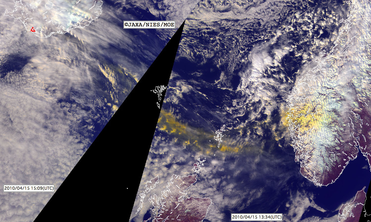
Figure 2. An enlargement of a region with ash plume in Figure 1. The observation time was about 10:30 pm, April 15 (JST).(Click here to zoom the image)
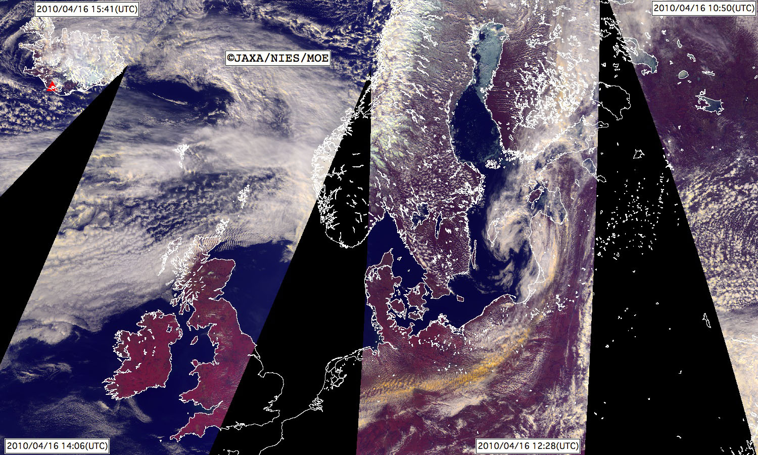
Figure 3. Same as Figure 1. This image was made from images acquired by "IBUKI" when it flew over Russia and Europe four times on April 16.(Click here to zoom the image)
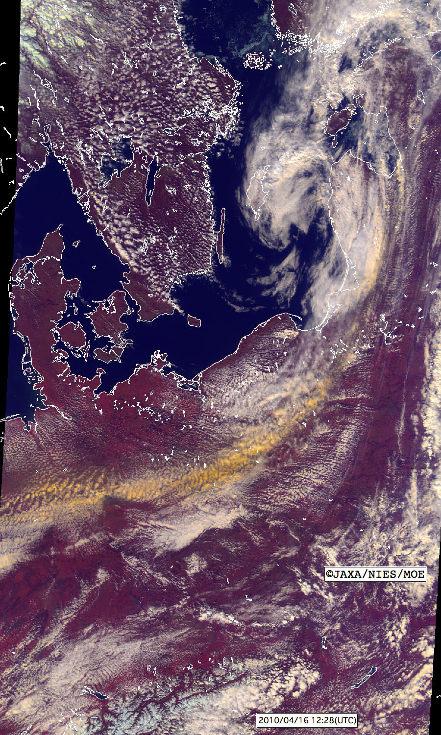
Figure 4. An enlargement of a region with ash plume in Figure 3. The observation time was about 9:30 pm, April 16 (JST).(Click here to zoom the image)
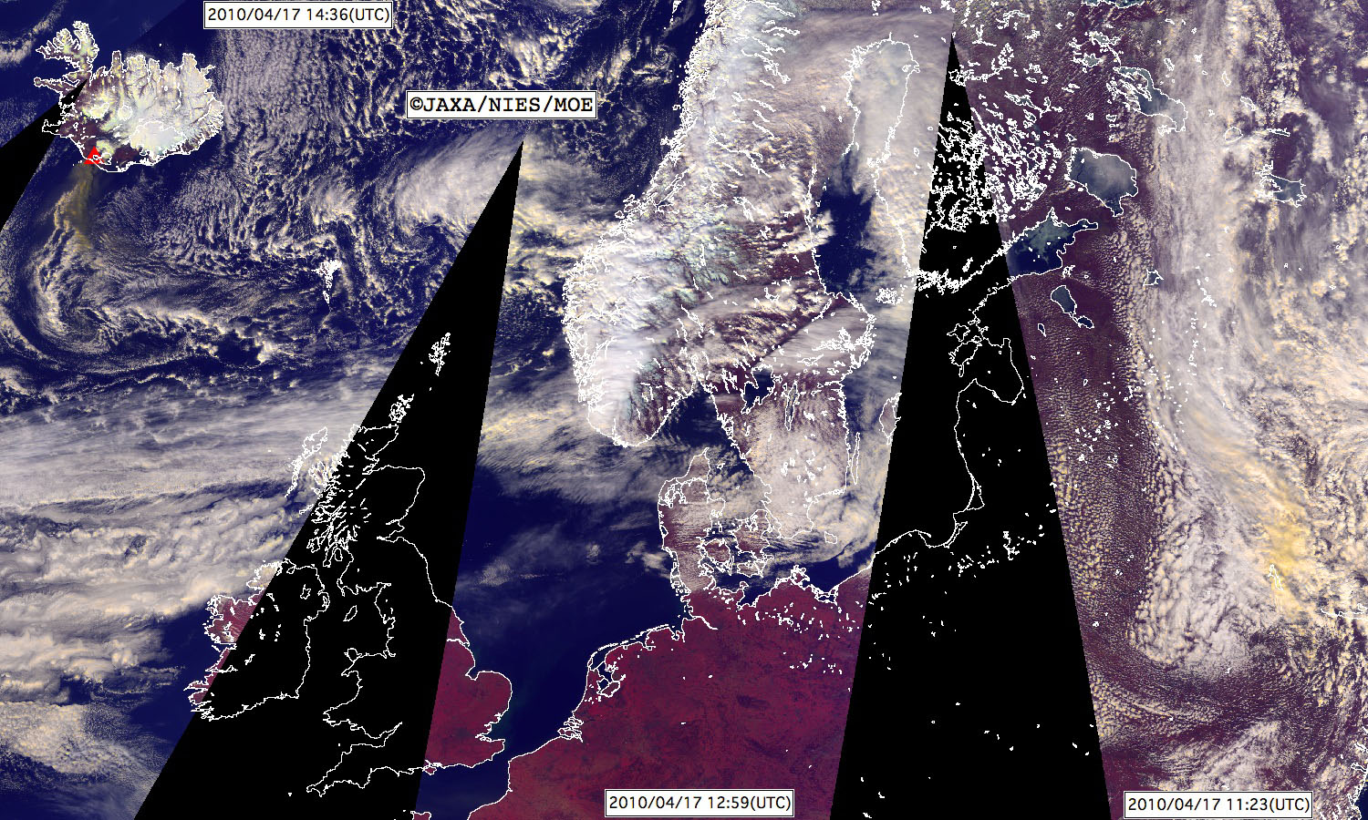
Figure 5. Same as Figure 1. This image was made from images acquired by "IBUKI" when it flew over Russia and Europe three times on April 17.(Click here to zoom the image)
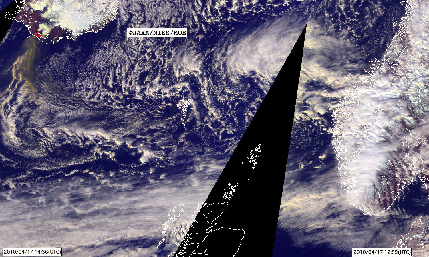
Figure 6. An enlargement of a region with an erupting volcano in Figure 5. The observation time was about 11:30 pm, April 17 (JST).(Click here to zoom the image)
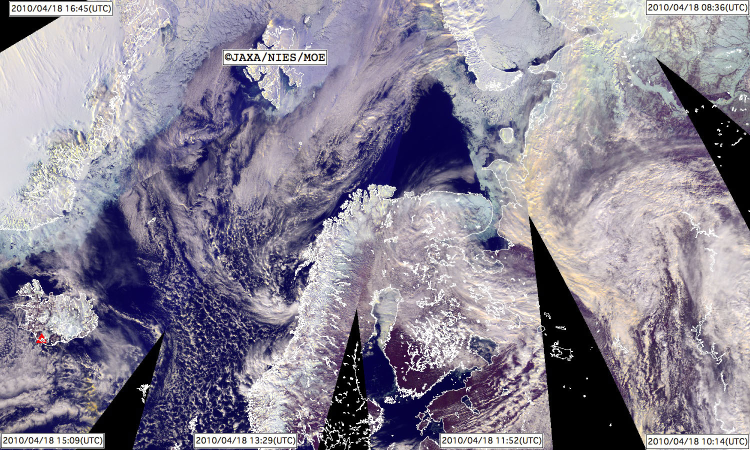
Figure 7. Same as Figure 1. This image was made from images acquired by "IBUKI" when it flew over Siberia and Europe six times on April 18.(Click here to zoom the image)
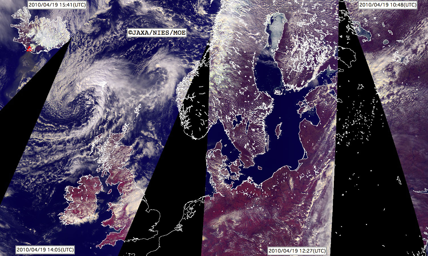
Figure 8. Same as Figure 1. This image was made from images acquired by "IBUKI" when it flew over Russia and Europe four times on April 19.(Click here to zoom the image)
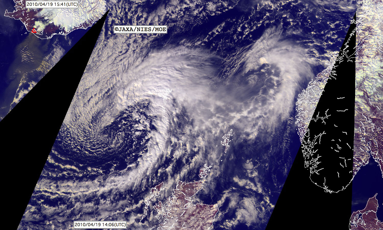
Figure 9. An enlargement of a region with an erupting volcano in Figure 8. The observation time (left) was about 0:40 am, April 20 (JST).(Click here to zoom the image)
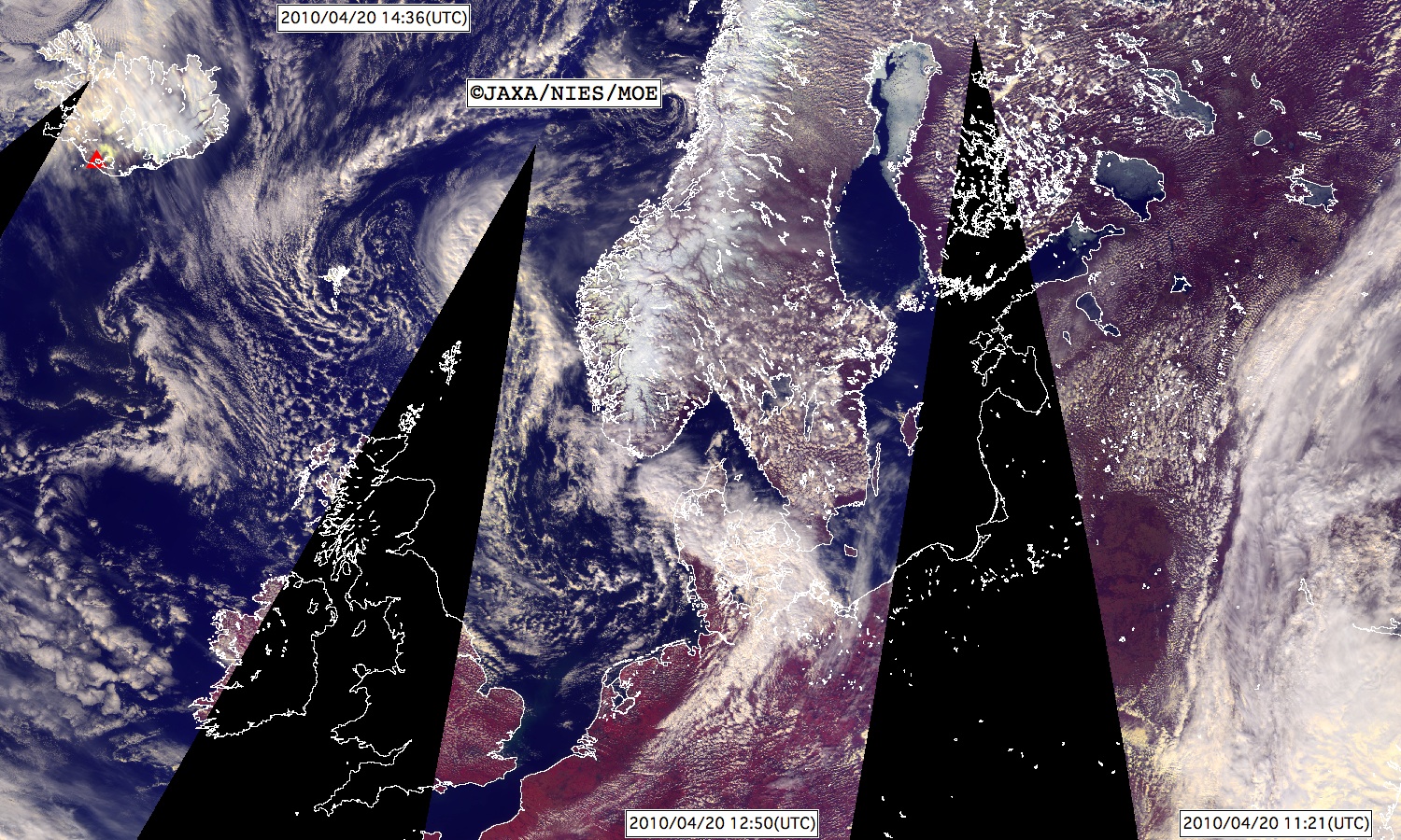
Figure 10. Same as Figure 1. This image was made from images acquired by "IBUKI" when it flew over Russia and Europe four times on April 20.(Click here to zoom the image)
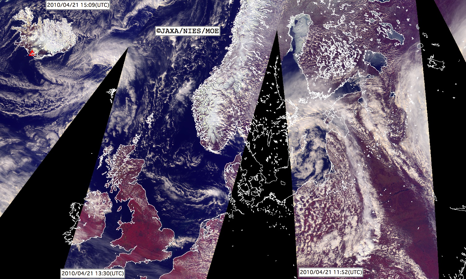
Figure 11. Same as Figure 1. This image was made from images acquired by "IBUKI" when it flew over Russia and Europe four times on April 21.(Click here to zoom the image)
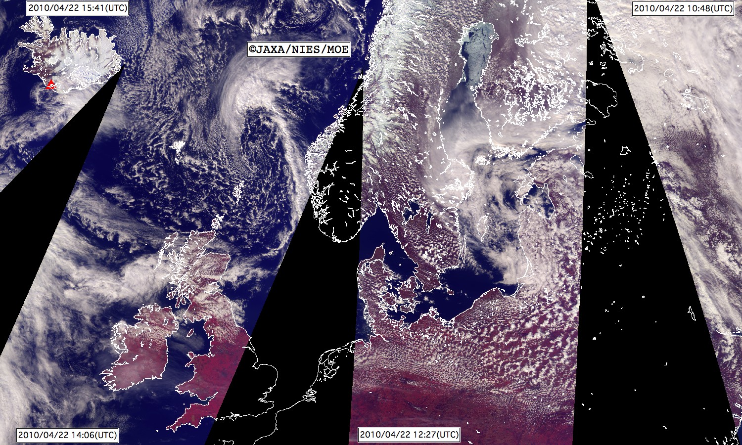
Figure 12. Same as Figure 1. This image was made from images acquired by "IBUKI" when it flew over Russia and Europe four times on April 22.(Click here to zoom the image)

Figure 13. An enlargement of a region with an erupting volcano in Figure 12. The observation time was about 0:40 am, April 23 (JST).(Click here to zoom the image)
* 870 nm, 678 nm, and 380 nm spectral bands are located in the near infrared, visible, and ultra violet spectral regions, respectively. "IBUKI" observed the sunlight reflected at land surfaces and clouds in these regions.
** "IBUKI" orbits the Earth in 98 minutes passing north and south poles each time at the altitude of 666 km. Thus the time difference between images taken in subsequent passes is about 98 minutes.
(National Institute for Environmental Studies)