
GOSAT captured smoke rising from massive wildfire in northern California (acquired on Nov. 10 and Nov.16, 2018)
GOSAT observes entire globe every three days with onboard sensors: Thermal And Near infrared Sensor for carbon Observation - Fourier Transform Spectrometer (TANSO-FTS); -Cloud and Aerosol Imager (TANSO-CAI).
Images acquired by TANSO-CAI on November 10 and November 16, 2018 showed the smoke rising from massive wild-fire occurred in Paradise, California, western United States.
The deadliest and most destructive wildfire in California’s history has finally been fully contained after more than two weeks since its start on November 8, 2018, officials announced on November 25, 2018. By that day, 87 people have been confirmed dead and at least 249 people remained missing.
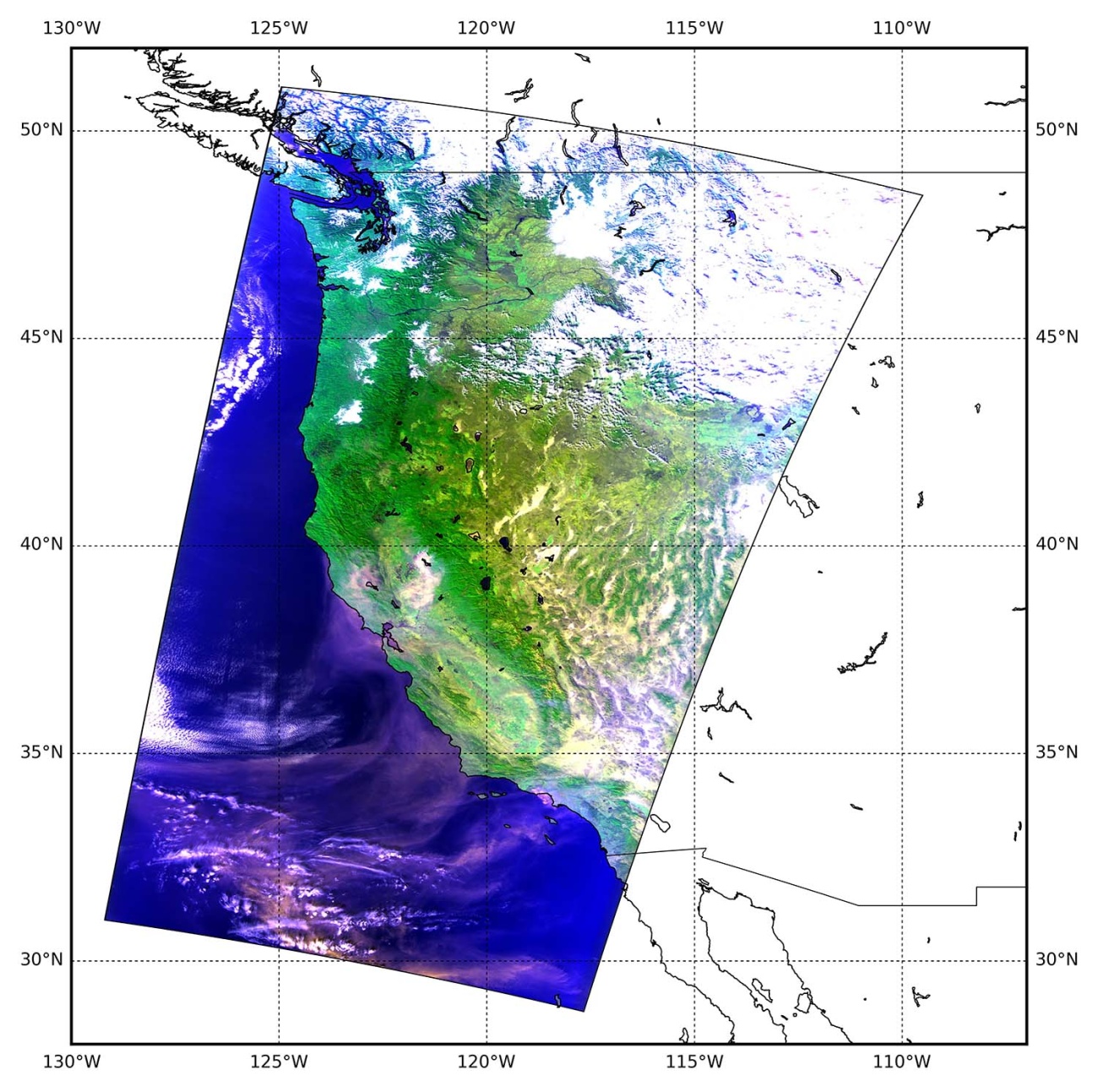
An image of smoke rising from the wildfire in northern California captured by GOSAT on November 10, 2018 (JST), depicting that fire smoke is flowing up to the Pacific Ocean.
The image is synthesized by assigning light acquired by TANSO-CAI at 380, 674, and 870 nm wavelength channels1) to blue, red, and green, respectively. Clouds are shown in white and fire smoke is in light blown.
(Please click the image to enlarge.)
- TANSO-CAI observes sunlight reflected from the Earth’s surface or from clouds with four channels (380, 674, 870 and 1600 nm) covering ultraviolet (UV), visible, near-infrared and short-wavelength infrared (SWIR) wavelength regions respectively.
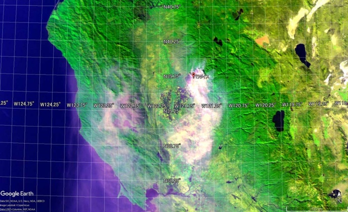
An image of the fire-site (Paradise, California) partially enlarged from the image on November 10, 2018 (Figure 1). To indicate the location of Paradise, the image obtained from Google Earth is utilized. The areas damaged by the fire are appeared in black.
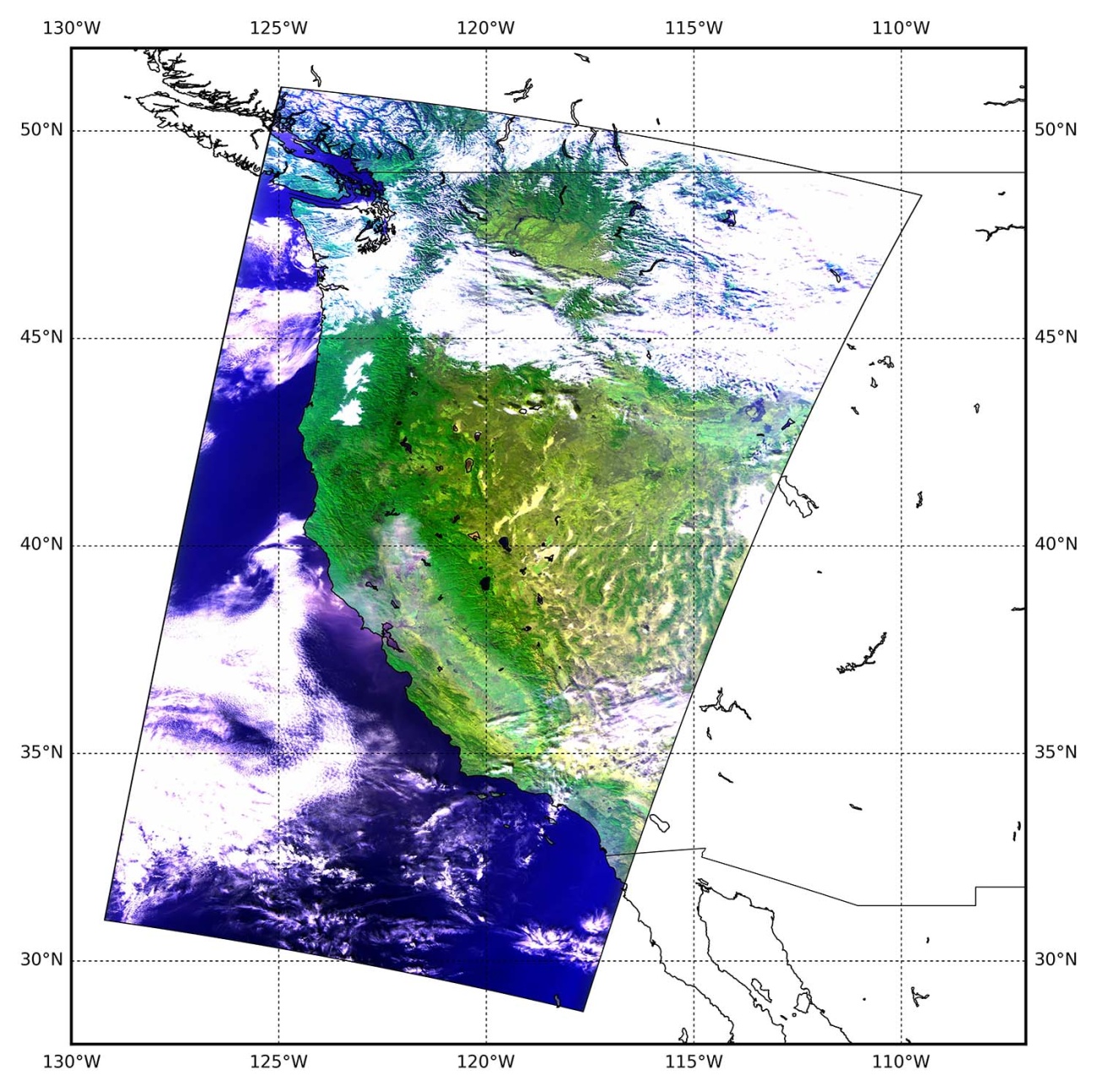
An image acquired by GOSAT on November 16, 2018 (JST) showing the wildfire in northern California, western United States. The fire had not yet been extinguished at this moment.
(Please click the image to enlarge.)
Notes:
Sensor: TANSO-CAI (Thermal And Near infrared Sensor for carbon Observation - Cloud and Aerosol Imager)
GOSAT Product utilized: CAI L1A data
Time and date:
Figure 1
9:35 – 9:37 pm (UT) (6:35 -6:37 am (JST)) on November 10, 2018 (Path 37)
Figure 2
9:35 – 9:37 pm (UT) (6:35 -6:37 am (JST)) on November 16, 2018 (Path 37)