| Abbreviation | Description |
|---|---|
| ADEOS | ADvanced Earth Observation Satellite |
| ADEOS-II/GLI | ADvanced Earth Observation Satellite-II/GLobal Imager |
| AERONET | AErosol RObotic NETwork |
| AIRS | Atmospheric InfraRed Sounder |
| ALOS | Advanced Land Observing Satellite |
| ASE | Association of Space Explorers |
| ASTER | Advanced Spaceborne Thermal Emission and Reflection Radiometer |
| ASTER GDEM | ASTER Global Digital Elevation Model |
| AT | Along Track |
| Abbreviation | Description |
|---|---|
| CAI | (See TANSO-CAI) |
| CALIPSO | Cloud-Aerosol Lidar and Infrared Pathfinder Satellite Observation |
| CAM | monitor CAMera |
| CME | Continuous CO2 Measuring Equipment |
| CNES | Centre National d'Etudes Spatiales (in French) : National Center of Space Studies (in English) |
| CSIRO | Commonwealth Scientific and Industrial Research Organization |
| CT | Cross Track |
| Abbreviation | Description |
|---|---|
| DB | Diode Box |
| DEM | Digital Elevation Model |
| Abbreviation | Description |
|---|---|
| ENVISAT | ENVIronmental SATellite |
| EOS | Earth Observing System (NASA Project) |
| Abbreviation | Description |
|---|---|
| FFT | Fast Fourier Transform |
| FTS | Fourier Transform Spectrometer, or see TANSO-FTS |
| Abbreviation | Description |
|---|---|
| GAW | Global Atmosphere Watch (WMO Project) |
| GCP | Ground Control Point |
| GOME | Global Ozone Monitoring Experiment |
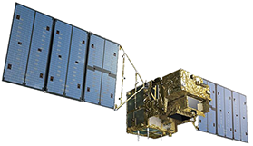
| GOSAT | Greenhouse gases Observing SATellite |
| GSFC | Goddard Space Flight Center(NASA) |
| GSHHS | Global Self-consistent Hierarchical High-resolution Shorelines |
| Abbreviation | Description |
|---|---|
| HDF | Hierarchical Data Format |
| HITRAN | HIgh-resolution TRANsmission molecular absorption database |
| HSTAR | High-resolution System for Transfer of Atmospheric Radiation |
| Abbreviation | Description |
|---|---|
| IASI | Infrared Atmospheric Sounding Interferometer |
| IGM | InterferoGraM |
| IIR | Imaging Infrared Radiometer |
| ILAS | Improved Limb Atmospheric Spectrometer |
| ILS | Indian Remote Sensing satellite |
| IMG | Interferometric Monitor for Greenhouse Gas |
| IRS | Indian Remote Sensing satellite |
| Abbreviation | Description |
|---|---|
| JAXA | Japan Aerospace Exploration Agency |
| JERS | Japanese Earth Resources Satellite |
| JPL | Jet Propulsion Laboratory |
| Abbreviation | Description |
|---|---|
| LLM | Light Load Mode |
| LUT | Look Up Table |
| Abbreviation | Description |
|---|---|
| MAP | Maximum A Posteriori |
| MDP | Mission Data Processor |
| MODIS | MODerate resolution Imaging Spectroradiometer |
| MOE | Ministry Of the Environment of Japan |
| MOS | Marine Observation Satellite |
| MTF | Modulation Transfer Function |
| Abbreviation | Description |
|---|---|
| NDACC | Network for the Detection of Atmospheric Composition Change |
| NDVI | Normalized Difference Vegetation Index |
| NetCDF | Network Common Data Form |
| NIES | National Institute for Environmental Studies (Japan) |
| NIR | Near InfraRed |
| NOAA | National Oceanic and Atmospheric Administration |
| Abbreviation | Description |
|---|---|
| OCO | Orbiting Carbon Observatory (NASA Spacecraft) |
| OMI | Ozone Monitoring Instrument |
| Abbreviation | Description |
|---|---|
| POLDER | POLarization and Directionality of the Earth's Reflectances |
| PPDF | Photon Pathlength Distribution Function |
| PRISM | Panchromatic Remote sensing Instrument for Stereo Mapping |
| Abbreviation | Description |
|---|---|
| RA | Research Announcement |
| RAMCES | Reseau Atmospherique de Mesure des Composes a Effet de Serre (in French) : Near Real Time CO2 Concentration (in English) |
| ROLO | RObotic Lunar Observatory |
| RSTAR | Remote sensing System for Transfer of Atmospheric Radiation |
| Abbreviation | Description |
|---|---|
| SAR | Synthetic Aperture Radar |
| SCIAMACHY | SCanning Imaging Absorption spectroMeter for Atmospheric CartograpHY |
| S-LLM | Super-Light Load Mode |
| SNR | Signal to Noise Ratio |
| SPOT | Satellite Pour l'Observation de la Terre |
| SPRINTARS | Spectral Radiation-Transport Model for Aerosol Species |
| SRTM | Shuttle Radar Topographic Mission |
| SST | Sea Surface Temperature |
| ST | Science Team |
| SWIR | Short Wavelength InfraRed / Short Wave Infrared Radiometer |
| Abbreviation | Description |
|---|---|
| TANSO | Thermal And Near infrared Sensor for carbon Observation |
| TANSO-CAI | TANSO-Cloud and Aerosol Imager |
| TANSO-FTS | TANSO-Fourier Transform Spectrometer |
| TCCON | Total Carbon Column Observing Network |
| TES | Tropospheric Emission Spectrometer |
| TIR | Thermal Infrared Radiometer |
| TOMS | Total Ozone Mapping Spectrometer |
| TRANSCOM | atmospheric tracer TRANSport model interCOMparison project |
| TRMM | Tropical Rainfall Measuring Mission |
| Abbreviation | Description |
|---|---|
| U, E, C | Unchecked, Evaluated, Confirmed (Stages of Evaluation) |
| U, P, Ca, C | Unchecked, Preliminarily checked, Calibrated, Confirmed (Stages of Calibration) |
| U, P, Ch, C | Unchecked, Preliminarily checked, Checked, Confirmed (Stages of Check) |
| U, P, V, C | Unchecked, Preliminary checked, Validated, Confirmed (Stages of Validation); Unchecked, Preliminary checked, Validated nominally (for L2 research products) |
| USGS | U.S. Geological Survey |
| Abbreviation | Description |
|---|---|
| VGA | Video Graphics Array |
| Abbreviation | Description |
|---|---|
| WDCGG | World Data Centre for Greenhouse Gases |
| WFC | high-resolution Wide Field Camera |
| WMO | World Meteorological Organization |
| WWW | World Wide Web |
| Abbreviation | Description |
|---|---|
| ZPD | Zero Path Difference |
Privacy Policy | Link | Glossary
Copyright © National Institute for Environmental Studies. All Rights Reserved.


